Saturday, May 31, 2025

For the birds


Nighthawk watch

When Marisol and I birdwatch near our northern Virginia home, we consider ourselves lucky if we see a single new bird species during an outing.


During a recent weeklong visit to Arizona, we added more than 100 new bird species to our first-time-viewed lists,  including such area trophies as the Elegant Trogon, the Red Phalarope and the Mexican Spotted Owl. 


Our success was partly due to timing: The early-May visit caught many species just as they were migrating to the north from their winter homes in Mexico and other points to the south.

We also benefited tremendously by participating in a guided trip sponsored by the American Museum of Natural History at its Southwestern Research Station near Portal, Arizona. The week-long birding tour in the Chiricahua Mountains was a fun learning experience for us that brought together ten enthusiastic birders from different states.


The station reminded me of a summer camp I attended as a child. Like the summer camp, the station has dormitories and a cafeteria. But unlike the summer camp, the station includes facilities for visiting research scientists and a feeding station that attracts a variety of hummingbirds.


The station’s accommodations were comfortable and the cooks provided great meals in a family setting. The station’s staffers were friendly and helpful. “I also enjoyed the camaraderie of our group, and I appreciated their willingness to share their knowledge,” Marisol said.


Feeding station
PD Hulce, the amiable veteran birder who led our group, not only was able to identify the birds we saw but also knew where to look for them. He led our group on numerous trips through various habitats in the area, including to a lake adjacent to a golf course in Willcox, AZ. 


Among the trip highlights for me were the early-morning hunts for warblers near their natural water sources in the mountain forests and an evening visit to observe nighthawks swooping over a pond seeking insects.


During our stay, we also visited several nearby feeding stations. At these sites, hosts attract birds with a variety of seeds, sections of oranges, peanut butter and grape jelly. Hummingbirds are fed a syrupy solution of sugar water.


At the stations, Marisol and I saw many new-for-us birds, including the colorful summer tanager, the black-headed bunting and the ladder-backed woodpecker. We loved being able to see so many new birds so quickly in this relaxed setting, but we both preferred the thrill and challenge of finding birds in their natural habitats along the forested mountainside roads and trails. 


We saw a lot. We learned a lot. And we had a lot of fun. Five stars.


Marisol, PD Hulce


Elegant Trogan, Photo: Tom Savage

Hooded oriole
Acorn woodpecker


Black-headed grosbeak


The Team; photo: Tom Savage

Author takes one for the team

Two additional photos by Tom Savage, a member of our group:


Nighthawk


Wednesday, May 28, 2025

The camino provides

Portuguese Coastal

If you hike in Portugal in the early spring, don’t forget to bring some serious rain gear.

Or that’s one of the lessons I learned this April while hiking the Camino Portuguese. It rained for the first two days of the hike, and it came down hard at times.


A little rain in the spring while hiking is to be expected, a routine part of the outdoor experience. But this Portuguese rain morphed into one of the most powerful storms I’ve ever been in. 


On day one, out of Porto, while I was hiking north on the coastal route, the wind and rain were off-and-on, persistent but manageable. On day two, though, after I switched to the central route, the early-morning rain was torrential. The 75-kph wind gusts broke my umbrella and the wind blew the rain horizontally into the hood of my raincoat, drenching me inside the jacket. It was 50 degrees that morning, so I was not only miserably wet but also freezing and even felt like I might be on the verge of hypothermia.


Fortunately, after sloshing onward through the ankle-deep puddles on the remote countryside road north of Vilarinho,  I made it to a tiny town. There, just as I was approaching, a woman was opening the only bar for miles in each direction. What a relief. I entered, had 2 cups of cafe con leche (coffee with milk) and a grilled ham-and-cheese sandwich.

Camino angel tending the bar


With heavy rains forecast to continue through much of the day, I hit the reset button. At my request, the lady in the bar called the local cab driver, and he gave me a ride to Ponte de Lima, 60 km to the north. There I waited out the storm sipping vino tinto (red wine) and cafe con leche in a posh seafood restaurant across the cobbled road from the town’s excellent albergue.


The weather was beautiful throughout most of the remaining 17 days of my trek ( just a day or two of light, scattered showers), and it didn’t start raining seriously again until the evening of April 10, after I had already safely arrived in Spain’s Santiago de Compostela.


It is said that camino provides to protect peregrinos, and arriving at this bar just as it was opening during the height of the storm is an example of the kind of good fortune I have experienced during my camino walks thus far. But I won’t press my luck. The next time I hike a camino in the spring, I’ll bring a poncho to back up the raincoat, just in case.


During this spring’s adventure, I hiked on two of the Caminos de Santiago—the Portuguese and the Invierno. More than a dozen of these ancient Catholic pilgrimage routes cross Europe and Spain and converge on the majestic cathedral in Santiago de Compostela, Spain. The remains of Santiago (Saint James) are said to be buried in a tomb in the cathedral.


Peregrinos, or pilgrims, have been hiking the camino routes for many centuries to seek forgiveness of their sins and more recently also for other purposes. Some devout Catholics believe that completing one of the routes guarantees them a spot in heaven. 


I was originally hoping to hike the section of the Portuguese camino all the way between Porto and Santiago this year. But I ended up restarting the trek in Point de Lima, PT, to get back on schedule after being delayed by the two days of stormy weather.

Damp footpath

After I completed the 152-km section of the Portuguese camino, I took a bus from Santiago to Ponferrada, Spain, and then hiked the 253-km Camino Invierno back to the cathedral.


Of the two Caminos, I preferred the Invierno but think the Portuguese route would be a far better choice for less-experienced trekkers. The Invierno is much less-traveled than the Portuguese, has far fewer services and goes through more remote territory. There is also less English spoken on the Invierno than on the Portuguese. 


That the Invierno is less-traveled than the Portuguese could be a bit of an understatement. Of the half million peregrinos who hiked caminos last year, 170,254, or 34%, received compostelas (certificates of completion) for hiking at least the last 100 km of one of the two main Portuguese camino routes, according to the Pilgrim’s Reception Office, the organization that issues the certificates in Santiago. The office said that only 2,869, or less than 1/2 of one percent of peregrinos received compostelas for hiking the Invierno.


Practically, this meant that while hiking the Portuguese camino, I ran into dozens of other peregrinos each day, on the trail and in the albergues. On the Invierno, I sometimes didn’t see another peregrino all day, and on several occasions, had only one other albergue roommate at night.

No-pack look on the Portuguese


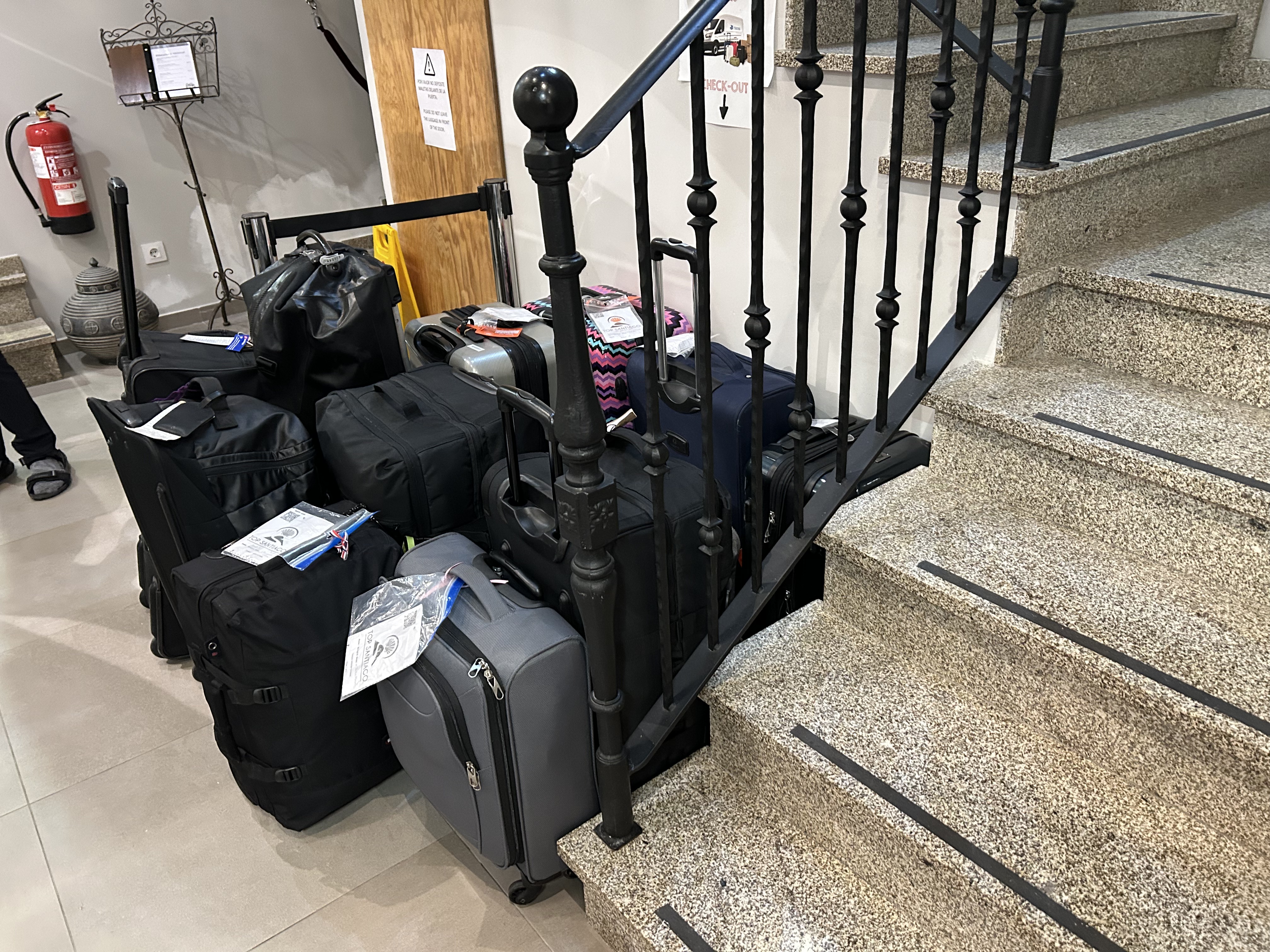
One difference I noticed between the pilgrims hiking the Portuguese and Invierno caminos is that many of the hikers on the Portuguese were carrying only a few daily essentials in small daypacks and using shuttle services to transport most of their belongings between stops. The handful of other Invierno hikers I met all seemed to be carrying most of their own luggage in their backpacks.


Overall, I hiked an average of 15 miles a day during this adventure. I often started hiking before madrugada (dawn) to get to my destination before 4 p.m., when many restaurants close for siesta.


Many of the restaurants in Spain reopen for dinner at 8 or 9  p.m. but that’s past my bedtime during these adventures because I need at least 10 hours of sleep a night to continue hiking day-after-day like this.


One of the toughest but most beautiful hikes on the Invierno for me was the 19.7-mile trek through the hilly countryside between Montforte de Lemos and Chantada. This section of the camino includes a lot of what the Spanish refer to as “romper piernas” (leg breakers or steep sustained climbs). But the weather was perfect—sunny, cool and breezy—and the views were spectacular. Buen camino.


Canadian family on the Portuguese


Sunrise over vineyard


Traveling companions Jose, 62, and Salvador, 78


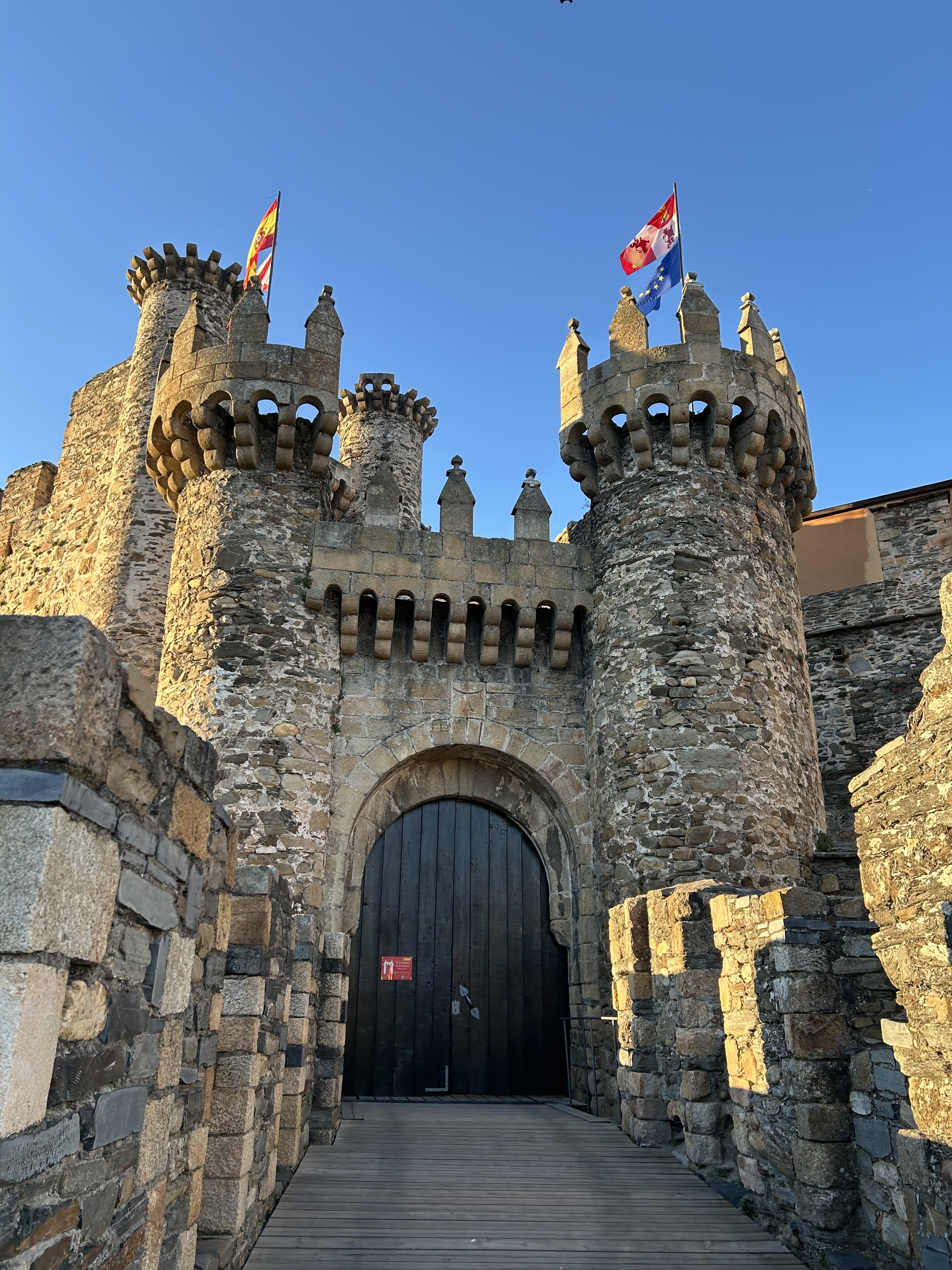
Templar Castle Ponferrada

Huge trout in this river


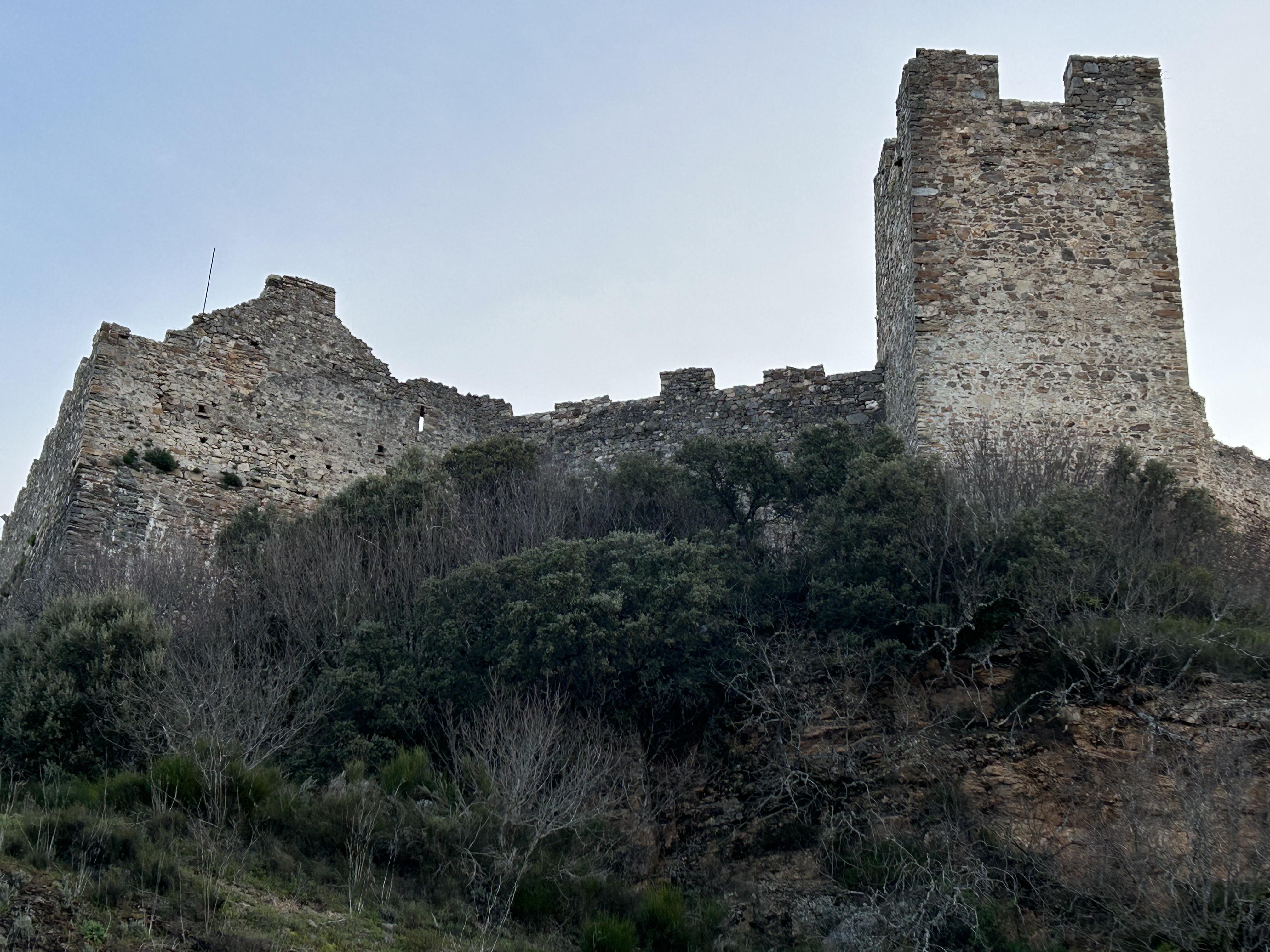
Castle overlooking Villa Viaje


Fresh sardines in Porto

Peregrino luggage for the shuttle service

Another predawn start

Frank, Spanish peregrino, enjoying cerveza breakfast

Camino folk art

River Sil

Lots of storks

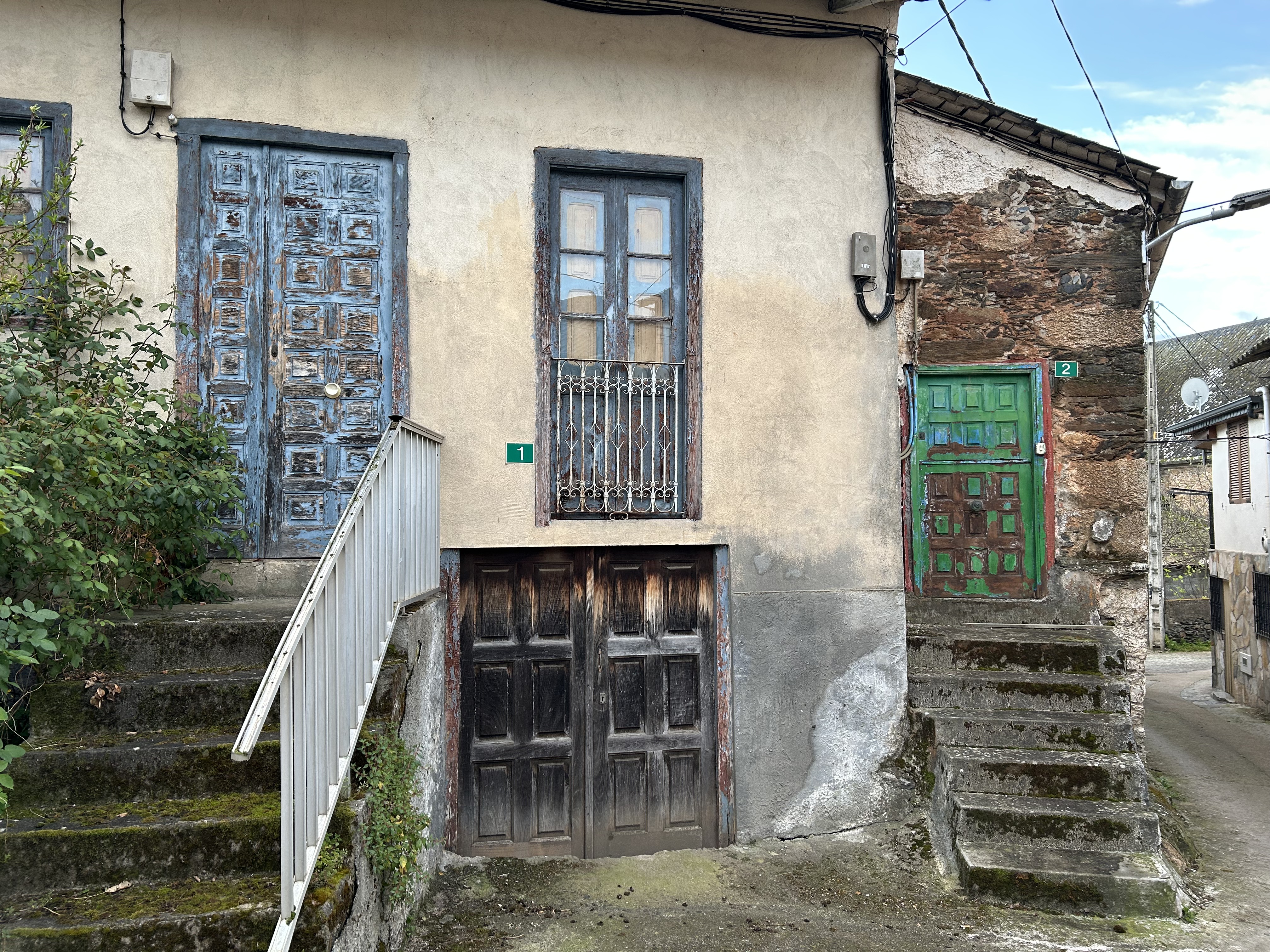
Great doors in Spain

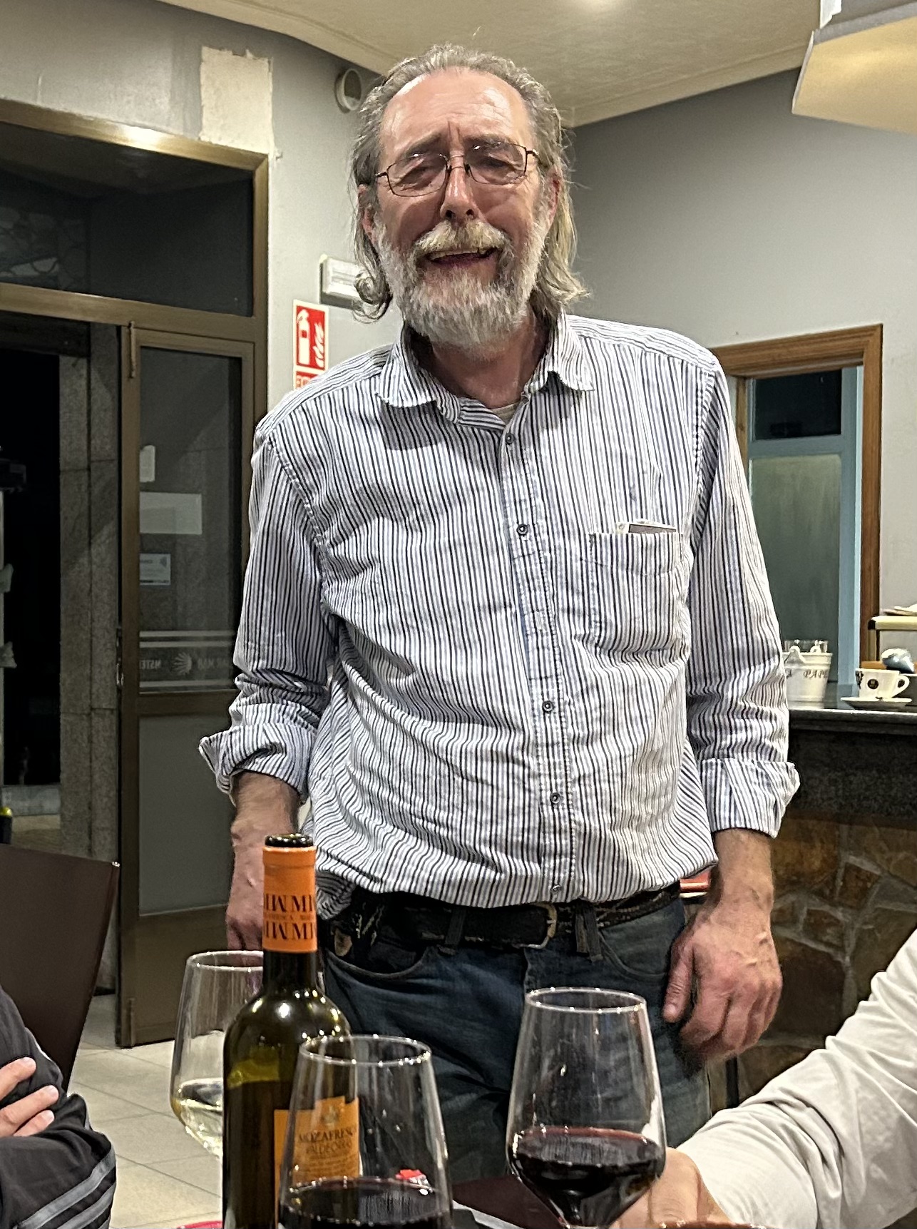
Manuel, legendary proprietor of Sobradelo Bar Mar

The yellow arrows mark the way

The gang at Casa Leiras in Dornelas

Santiago cathedral

I always light a candle during my visits

Pilgrim's mass

Tuesday, December 24, 2024

John Muir Trail: How I got it done


California’s 211-mile John Muir Trail, which starts in Yosemite National Park and ends on top of 14,505-foot Mt. Whitney, is a scenic wonder and deserves a spot on the bucket lists of adventurers of all ages.


But with more than 45,000 feet of rugged, steep climbing, much of it at elevations higher than 8,000 feet above sea level, it’s no walk in the park. Many who start the route fail to complete it.


I’m happy to report that I was able to hike the whole thing this past summer. I credit my success to training for the adventure, acclimating in advance, traveling as lightly as reasonably possible, and taking it easy, particularly during the first days of the trek. I also was blessed with good luck.


I started training specifically for the trail several months in advance of my July 31 permit start date by hiking 5-10 miles several times each week, with anywhere from 30 to 40 pounds of weight in my backpack. This was as much or more than I actually carried during the hike. This helped a lot, I think. During these training walks, I wore the shoes and socks I used on the JMT, to make sure they didn’t cause blisters or other foot or leg problems. 


As a lifetime resident of sea-level areas, I knew that the route’s elevation would be one of its biggest challenges for me. So I budgeted three extra days to acclimate immediately before the hike. I did this during a camping/fishing adventure at Mammoth Lakes CA, a ski resort town near Yosemite. The elevation in town is 7,800 feet above sea level, and the nearby lakes and ski areas are higher.


The lucky part was that I avoided signicant injury throughout. It could have gone south for me on several occasions, including once when I took a nasty fall in a bouldery creek. I landed on my back, sprawled among the rocks, but miraculously avoided any consequence more serious than a bruised ego. On another occasion, while I was completely alone on a little-used side trail heading back to the JMT from Vermilion Valley Resort, one of my resupply stops, I narrowly avoided stepping on a rattlesnake.


As a veteran long-distance touring cyclist and hiker, I already owned much of the ultra-light gear I used on this hike. But for this adventure, I acquired a new 2-pound, one-man tent (Durston X-Mid 1) that sets up with my trekking poles. It worked great. Five stars.

The Durston


I also used a 44-ounce ULA Catalyst backpack. It proved to be another winner. It was very comfortable and large enough to carry a 2.5-pound BearVault BV500 food canister horizontally. Bear cans are required on the JMT. I emptied the pack at night and slept with my feet on it inside the tent to protect it from critters. 


One of my favorite pieces of gear was a $15, ultralight, 7.8 W Lixada solar panel that clipped to the top of my backpack. I used it to recharge a 10,000 mAh Nitecore battery brick while I hiked each day. I then used the battery brick to fully recharge my iPhone 14 each night. I mostly used the phone for photos and navigation. Cell signals are only rarely accessible on the JMT.


Solar panel

My other rechargeable electronic devices—including a watch, ultralight flashlight and an emergency satellite beacon—really never required recharging. The watch, a Garmin Instinct 2 Solar, was always topped up because there was plenty of bright sunshine (don’t forget a wide-brimmed hat, sunscreen and SPF lip balm) on the trail.


To avoid having to pack out used TP (a Leave No Trace requirement on the trail), I used a portable CuloClean bidet instead of paper to tidy up. It worked very well, once I got the hang of it. (You have to use a wagbag to pack out your poop in the Mt. Whitney zone. So you need to bring a wagbag along, too.)


I am so glad I brought a pair of trekking poles. They saved me from many a fall and made it a lot easier to negotiate the trail’s steep descents. I also credit the clicking of the metal tips of the poles for awakening a timber rattler that had been napping in the middle of the trail. I didn’t see the beast, until it coiled and rattled a few feet ahead. It lashed out at me repeatedly, it’s head moving so rapidly it was a blur, before slithering off the path. Had the serpent not awakened, I might have stepped on it and suffered a trip-ending bite.

The sticks 


To minimize my load, I cold-soaked my breakfasts and dinners. Using cold water to rehydrate my meals allowed me to save the weight of a stove, cooking pot and fuel. My kitchen consisted of a titanium spoon and an empty plastic Talenti gelato container. Between my two main meals, I snacked on energy bars, jerky and meat sticks. I tired of the bars but always enjoyed the jerky and meat sticks, and genuinely looked forward to my breakfasts and dinners each day.


My breakfast cereal consisted of a mixture of equal parts of granola and Grape-Nuts, with dehydrated whole milk, instant coffee, cinammon, raisins, freeze-dried blueberries and walnuts.

Chili and Chuck

Dinners were a mixture of white rice, whole-wheat couscous, freeze-dried vegetables and beans, all of which rehydrate well without heat. I added a spice mixture that included half teaspoons of Massel chicken-flavored boullion, dried parsley, oregano, basil, turmeric, garlic powder and eighth teaspoons of pink salt and pepper. After soaking the mixture in water in the Talenti container for 20 minutes or so, I added a tablespoon of olive oil and a generous dash of Sriracha sauce, both of which are available in individual serving-sized packets. Delish. Pro tip: You can soak up extra water and add calories to your meal with freeze-dried mashed potatoes, which rehydrate instantly without heating.


I also added electrolyte mix to most of the water I drank during the hike. I carried both Nuun tablets and sachets of Ultima sugarless powder. I preferred the former, particularly the ones fortified with caffeine. The Nuuns, though heavier than the Ultima, gave me a bigger boost. You can break the Nuun tablets in half with your fingers to fit them into water bottles with narrower necks and mouths.

Fellow south bounders

It’s easier to get a northbound (NOBO) JMT hiking permit than to win a southbound (SOBO) permit in the YNP permit lottery. But I got lucky and scored a SOBO permit (starting from Yosemite’s Tuolumne Meadows), and I think that made it much easier for me to complete the hike.


With a NOBO permit, many start their treks at 10,000 feet above sea level (Cottonwood Pass trailhead) and ascend 14,505-foot Mt. Whitney—-the JMT’s highest point—within the first several days of their efforts.


With my SOBO Tuolumne permit, I started hiking at 8,600 feet above sea level. (Yosemite Valley, the other YNP starting point, is at 4,000 feet above sea level.) The Tuolumne permit let me more gradually work my way up though the trail’s higher passes—including Muir, 11,955 feet above sea level; Mather, 12,068; Pinchot, 12,090; Glen, 11,926, and Forester, 13,153. So by the time I reached Whitney (14,505), its elevation was not a problem for me.


Some of the stuff I brought along I didn’t use much—including raingear, a puffy jacket, long underwear and insect repellent. But I was glad to have it for the few occasions it was needed.


Other stuff I wasn’t using early in the going—including fishing gear and extra clothing—was mailed home during one of my resupply stops. My pre-hike fantasy was to stuff myself with freshly-caught trout every night. But the reality was I was too worn out from hiking each day to ever seriously consider wetting the monofilament. Eating, sleeping, and hiking was more than enough.


Another way to resupply

One of the more surprising things I noticed during my adventure was how ill-prepared (or maybe unlucky) some hikers seemed to be—especially considering how hard and expensive it is to get a permit, buy the required gear, and to arrange resupplies and transportation to and from the JMT trailheads.


One fellow I met bailed on Day 1, before 11,066-foot Donohoe Pass, because he was having a problem with the elevation. Another gentleman was getting off the trail after his partner had to be evacuated out by helicopter because the exertion was causing him to have severe asthma attacks. A younger couple, meanwhile, told me  they were quitting because they felt they weren’t in good enough physical shape and their packs were too heavy for them to enjoy the experience.


The most unprepared person I met was a Korean woman. I had just finished summiting Whitney and was taking a break at the Trail Crest junction 2 miles down the rocky path from the top when she approached anxiously.  I was in a hurry to get going because there was only an hour of daylight remaining to hike the 2.2 miles down the 99 switchbacks to the trail camp on the way to Whitney Portal. It was cold, and she was only wearing a light windbreaker. She had no backpack. The only gear she appeared to be carrying was a wadded-up Befree water-filter/bladder with maybe two tablespoons of water in it. “I separate my party,” she said. She meant that she was lost. She also asked for water. 


She spoke very little English, and I know zero Korean, so it took maybe five minutes to sort out. I finally determined that she was supposed to meet her friends at nearby Guitar Lake (she was calling it “Gitta Lake”), and I had noticed a pair of Asian hikers with packs heading down that way maybe five minutes before she arrived. So I put two and two together, gave her half of my water and got her started in the right direction. And then I headed in the opposite direction toward Trail Camp. Hope she caught up with her friends quickly. They looked worried, too, and now I knew why.








Riding Spain's caminos on a folding bicycle

Proving that an old Doug can learn a new trick, I just completed a 550-mile circuit of three of Spain’s caminos de Santiago on my foldable B...